
Our Projects
Our projects highlighting the power of agricultural drone scans with orthomosaic, thermal, RGB, DEM, and DSM imaging. Each scan demonstrates how our services provides actionable insights for farming, forestry, and land management. Experience the precision and innovation that are transforming sustainable practices across industries.
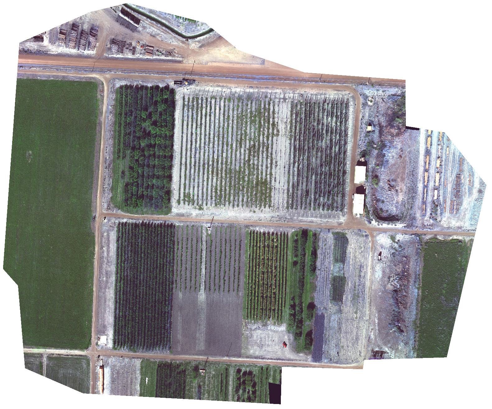
Agriculture RGB Scan
Red, green, blue images are used to create highly detailed maps of agriculture fields.
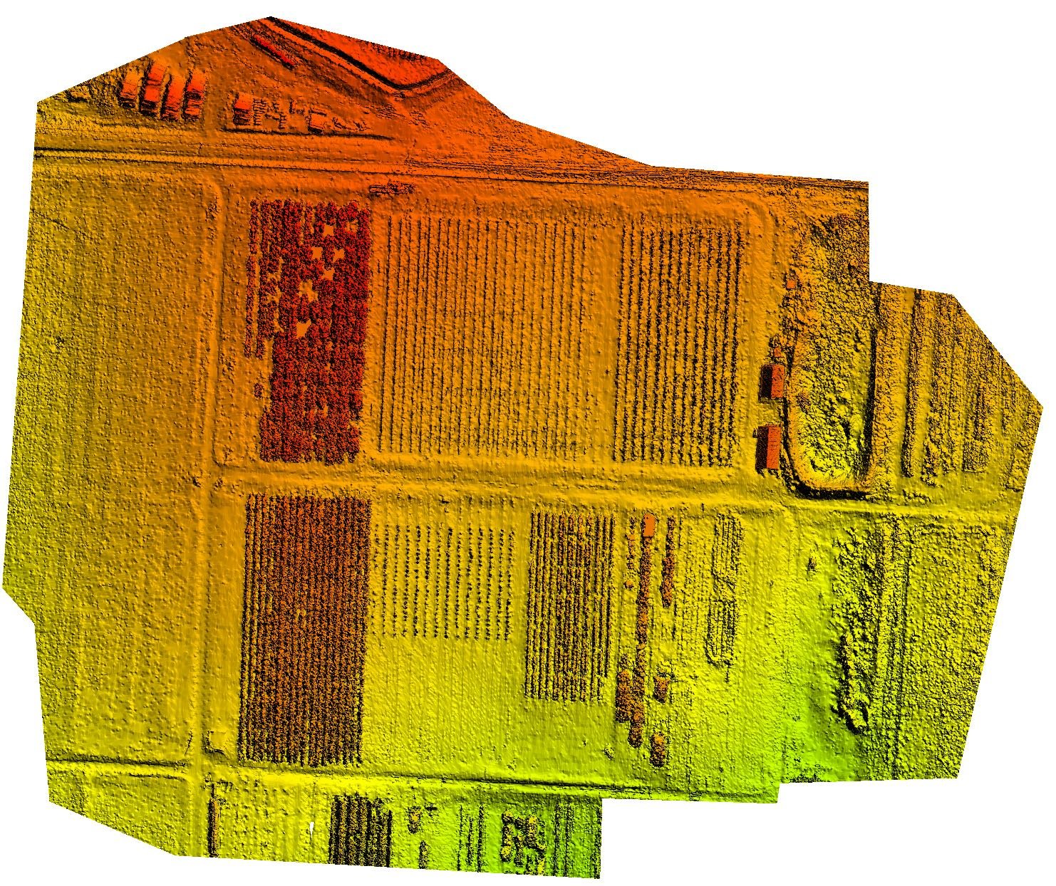
Agriculture DEM Scan
Digital elevation models are combined with the orthomosaic image to create accurate maps.
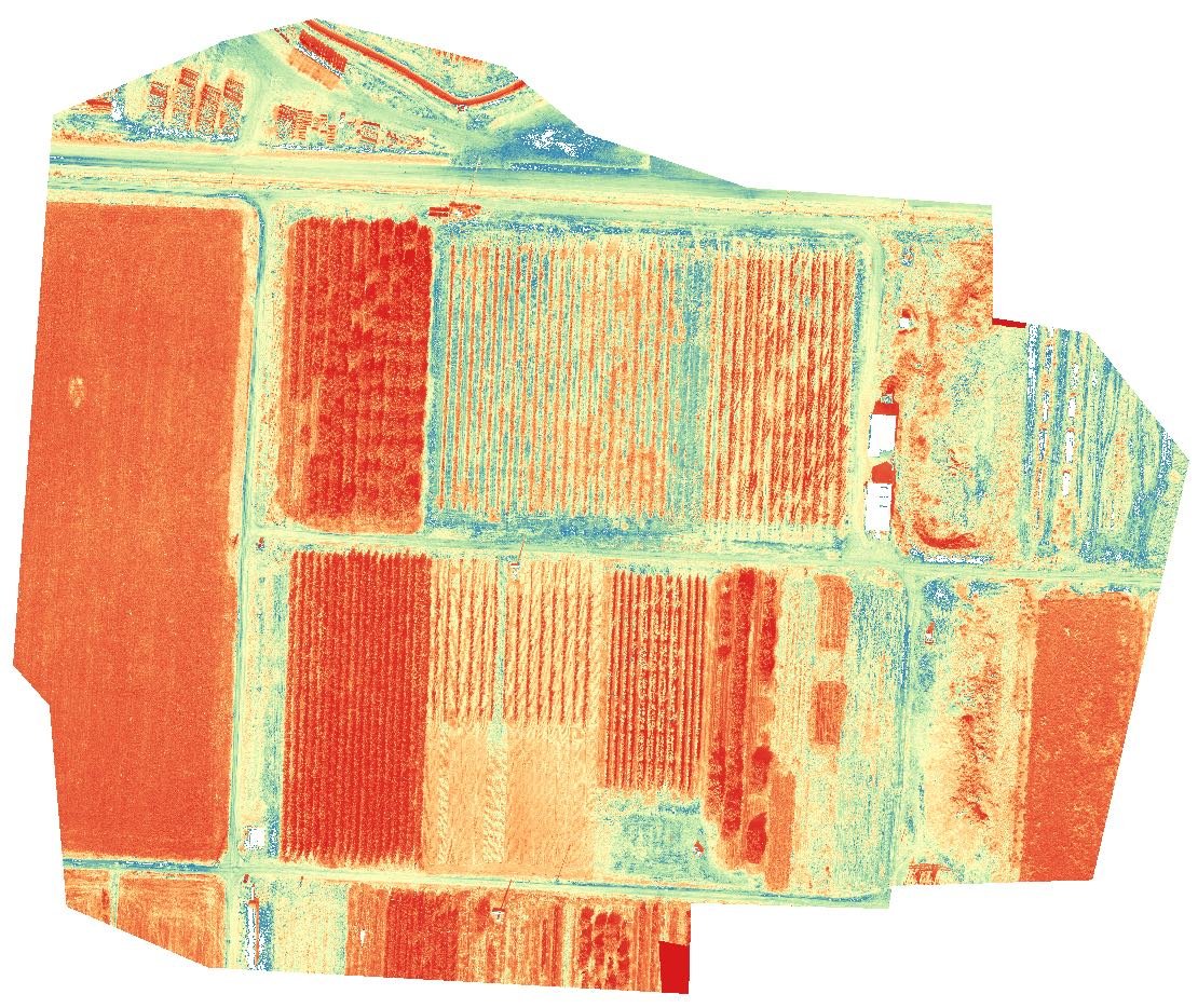
Agriculture Thermal Scan
Thermal images help farmers improve harvest strategies, manage water, and detect disease.
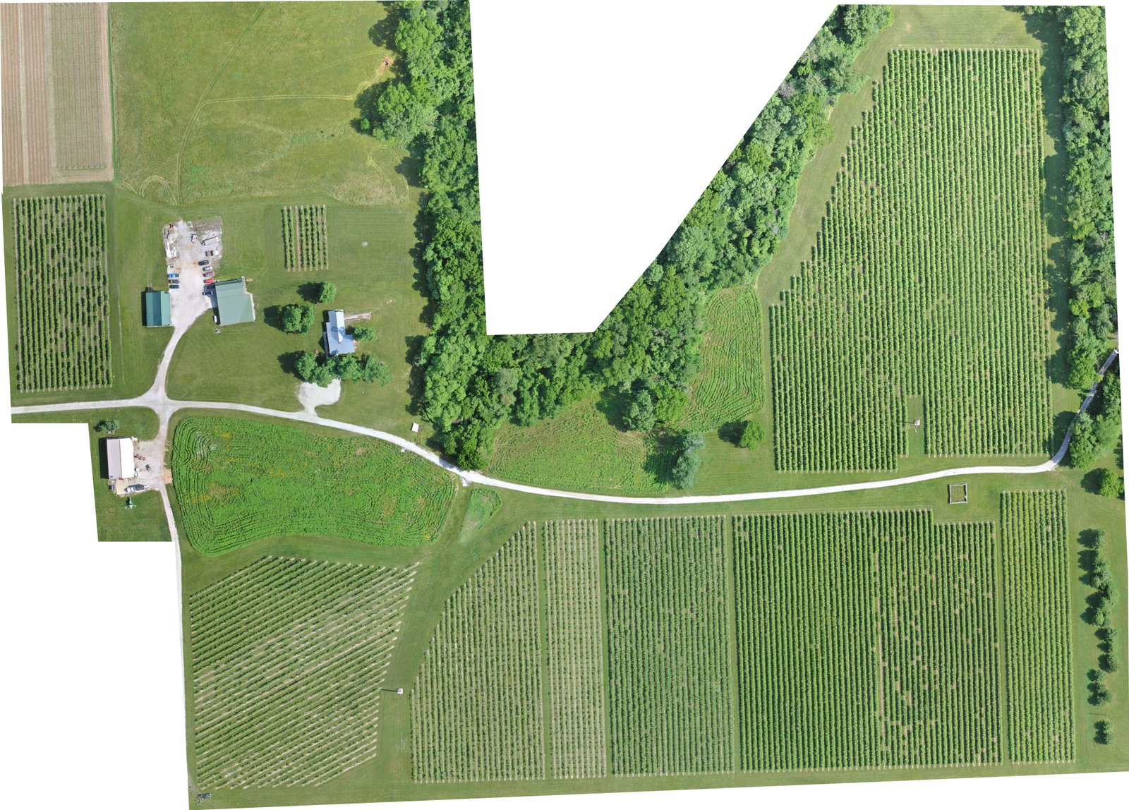
Farm House Orthomosaic Scan
High resolution scans helps farmers to get a detailed understanding of the vegetation.
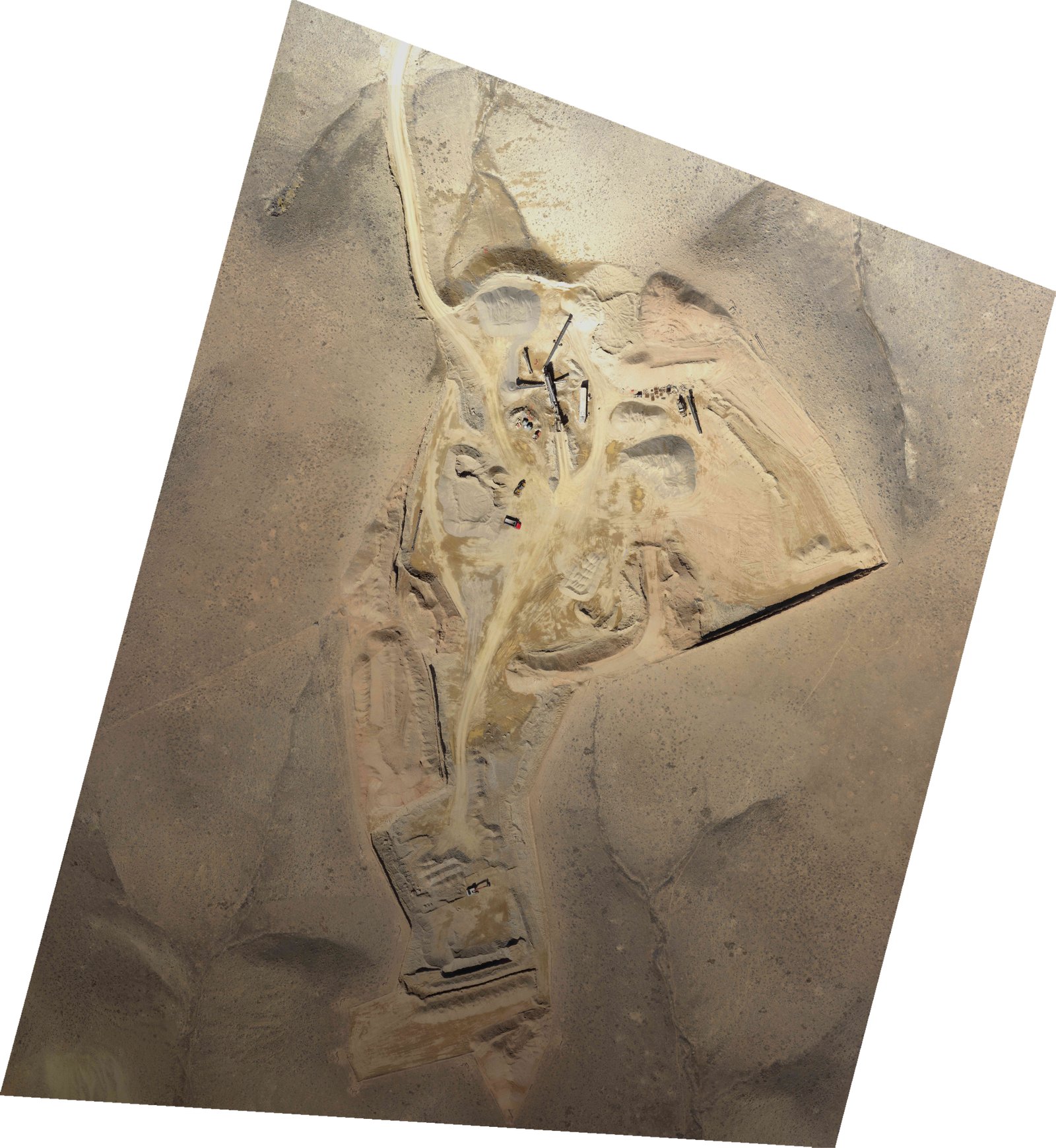
Gravel-pit Orthomosaic Scan
The orthomosaic images create a high quality image with high detail and resolution.
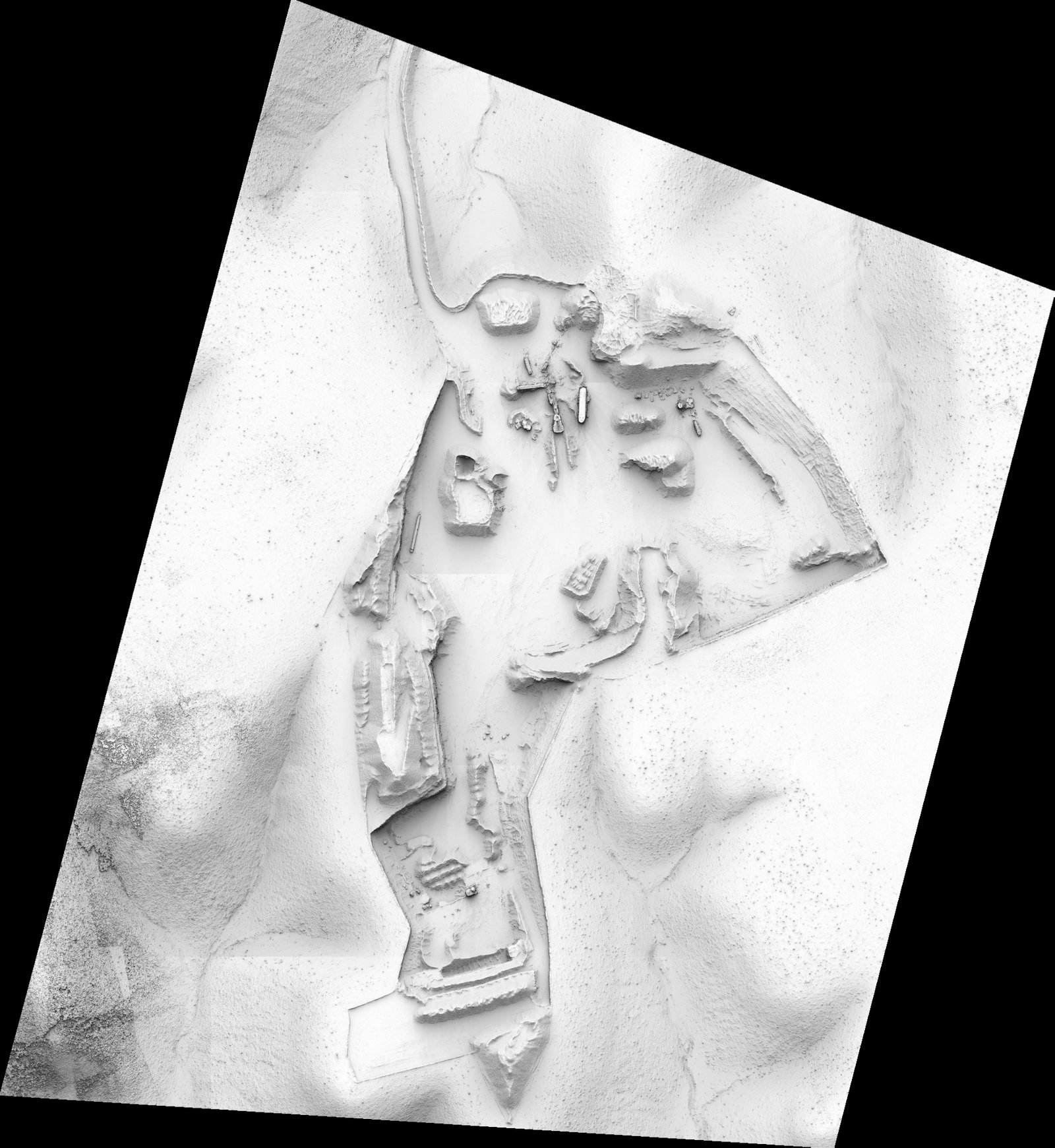
Gravel-pit DSM Scan
The Digital Surface Model helps reflect the over volume of the gravel-pit.